Mono Cliffs Provincial Park Trails Guide + The BEST Hiking Route
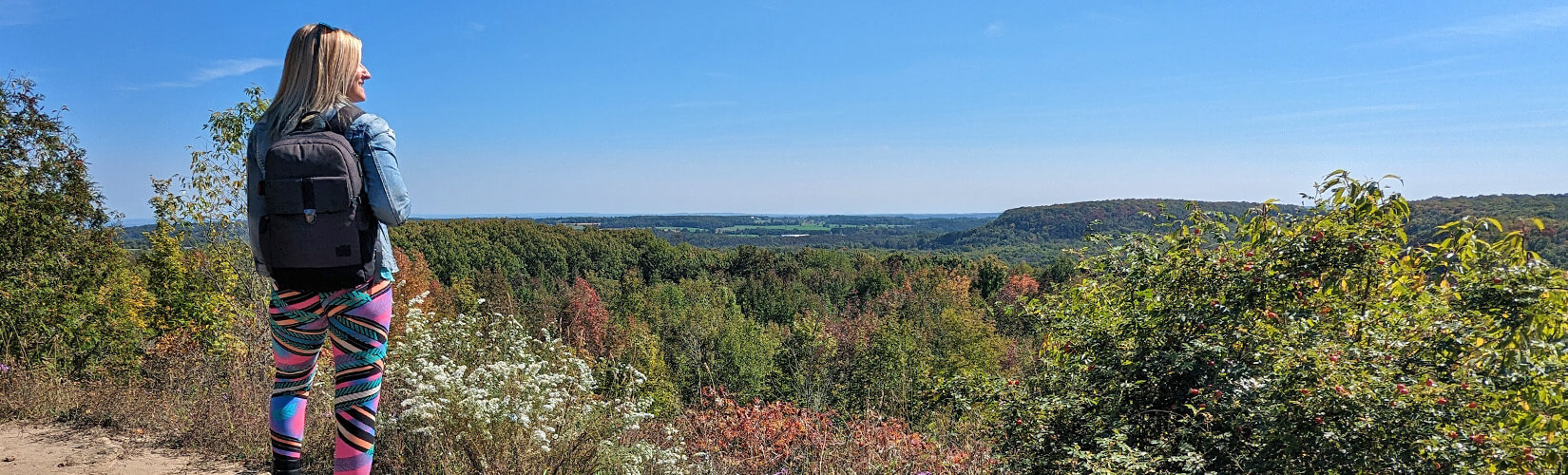
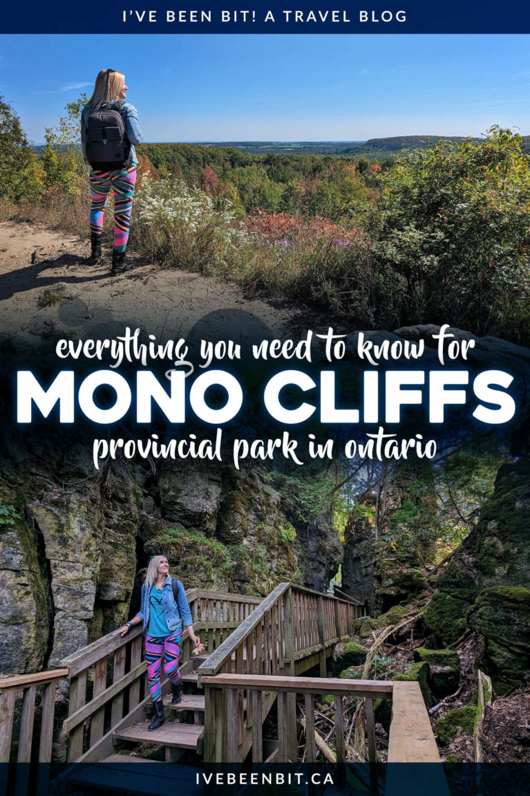
One of the most popular provincial parks in Southern Ontario, Mono Cliffs Provincial Park is bursting with natural beauty. It offers a medley of landscapes, stunning lookouts, and a number of unique features. As you’ve probably guessed from the name, the cliffs within the park are absolutely spectacular and are alone worth visiting!
The Mono Cliffs Provincial Park trails are not to be missed, especially since it’s just over an hour from Toronto and only 20 minutes from Orangeville. However, there are a few things you need to know when planning your visit. I have all the details in this Mono Cliffs Provincial Park guide!
Disclaimer: This post may contain affiliate links where I may receive a kickback at no extra cost to you. It helps keep IBB alive so thank you!
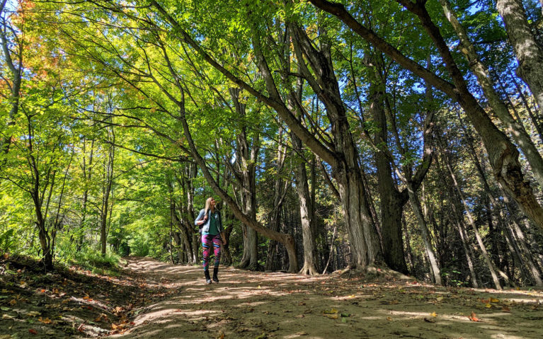
Lindsay Along the Carriage Trail in Mono Cliffs Provincial Park
TABLE OF CONTENTS
About Mono Cliffs Provincial Park
Mono Cliffs Provincial Park is on the Niagara Escarpment, a UNESCO World Biosphere Reserve. The Niagara Escarpment runs from Niagara Falls right up through Georgian Bay. It’s a very special place in the world, naturally and ecologically. There are numerous forests, cliffs, and wetlands that are home to hundreds of species of birds, fish, animals, reptiles and amphibians.
The Niagara Escarpment formed over millions of years through weather and the erosion of its rocks. There are harder rock layers above (dolomite and limestone), and softer rocks underneath that became eroded and weathered. To the north and south of Mono Cliffs, the Niagara Escarpment lies buried beneath thick deposits of rock, sand and gravel that were dumped by the glacier.
Mono Cliffs is a unique place where you’ll be able to walk between the rocky cliffs of the Niagara Escarpment, towering 30 feet overhead. Massive ice chunks also created McCarston’s Lake, which is a kettle lake. You’ll also be able to discover one of the largest concentrations of fern species in Ontario (44 in total!), including the rare Hart’s-tongue Fern.
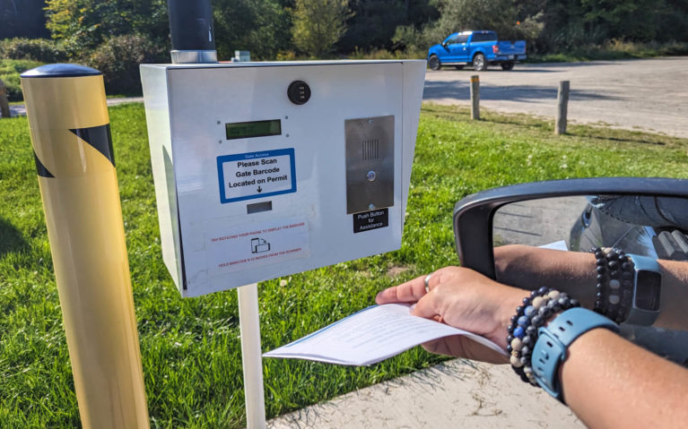
Scanning the Barcode at Mono Cliffs Provincial Park
Accessing Mono Cliffs Provincial Park
Mono Cliffs Provincial Park is located in the Headwaters Region of Ontario, approximately 20 minutes north of Orangeville. From the city, head north along Highway 10 to Mono Centre Road (also known as Dufferin Road 8) until you reach 3rd Line EHS. Follow the road for just under one kilometre and you’ll arrive at the Mono Cliffs parking lot. It’s quite easy to access and with its location 75 minutes from Toronto and just under an hour from Barrie, Mono Cliffs Provincial Park makes for a great day trip destination.
As with many provincial parks in Ontario, it’s required that you have a reservation prior to arrival. This means you will need to plan ahead for your Mono Cliffs visit! However as of September 2023, Ontario Parks has a new automatic gate system to help with this process.
In order to gain access to the Mono Cliffs Provincial Park trails, you must head to the Ontario Parks website and reserve your daily vehicle permit (DVP). Mono Cliffs offers full day permits as well as access in four hour time blocks starting at 8:00 am. If a full day permit is unavailable, select a different day to visit or opt for one of the four hour permits if capacity allows!
Once you have secured your reservation, you will receive an email with a barcode. Save the barcode to your phone or print it out to take with you as this is needed for entry. Then on the day and time of your reservation, head to Mono Cliffs Provincial Park where you will scan this code at the gate. The barricade should lift and voila, you’re ready to go! If you do run into any snags, hit the call button on the gate and an Ontario Parks staff will happily assist you.
Now that you’ve parked the car. Let’s strap on those hiking boots and hit the trails!
SOMETHING TO NOTE: Forks of the Credit Provincial Park is located just 30 minutes away and is another popular Ontario Parks location for hiking. They also have the same automatic gate system so make sure you’re prepared if you plan on visiting this park as well! Click here for more tips on planning your visit to Forks of the Credit Provincial Park.
-

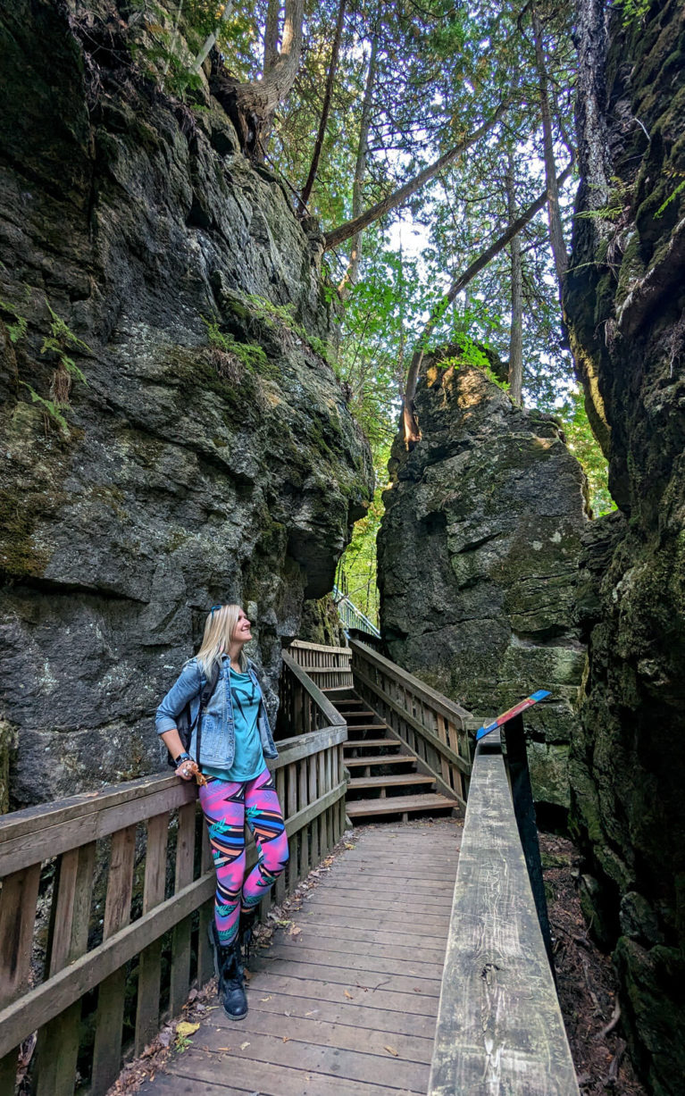
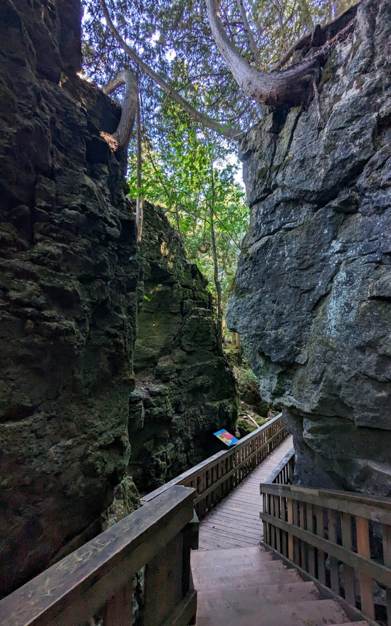
- At the Base of the Mono Cliffs
-
- View As You Enter the Cliffs
Mono Cliffs Provincial Park Trails
As you can see on the Mono Cliffs Provincial Park map above, the park offers 19 kilometres of hiking trails just waiting to be explored. You’ll find seven unique trails ranging from 600 metres in length to almost 5 kilometres. The trails are as follows:
- Carriage Trail (1.3 kilometres long)
- Cliff Top Side Trail (2.8 kilometres long)
- Lookout Trail (600 metres long)
- McCarston’s Lake Trail (3.6 kilometres long)
- South Outlier Trail (3.5 kilometres long)
- Spillway Trail (1.3 kilometres long)
- Walter Tovell Trail (4.8 kilometres long)
Visitors will also find markers for Ontario’s famous Bruce Trail. For those who aren’t familiar, the Bruce Trail is an approximately 900 kilometre long trail that roughly follows the Niagara Escarpment from Queenston Heights in the Niagara Region all the way up to Tobermory. It follows various sections of the South Outlier Trail, Walter Tovell Trail, Cliff-Top Side Trail and McCarston’s Lake Trail in Mono Cliffs Provincial Park. Check out my Bruce Trail guide to learn more about Ontario’s longest hiking trail!
Many of the trails intersect so it’s easy to create a loop, depending on how long you’d like to spend in the park. Whether you’d like to spend an hour or two hitting the highlights or spend an afternoon up to a full day truly appreciating the park, Mono Cliffs has you covered. Here’s a breakdown of what to expect along the Mono Cliffs Provincial Park trails.
Carriage Trail (1.3 km)
This will be your first taste of Mono Cliffs Provincial Park as it leads from the parking lot. It is depicted in red on the map. While most of the trails are forested, you’ll enjoy beautiful views of a rolling meadow before entering the heart of the park.
The Carriage Trail connects to some of the other Mono Cliffs Provincial Park trails including the South Outlier, Spillway and Cliff Top Trails. Along here, you’ll also see signs about a lookout platform which will take you to some stunning views as well as in the direction of the park’s main feature, the cliffs.
This route is also accessible for equestrian riders so you may just see someone on horseback as you’re hiking along it!
Cliff Top Side Trail (2.8 km)
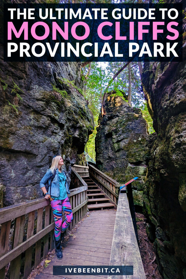
If you’re here to see the iconic cliffs, this is the trail you’re looking for! Close to the northern tip of the Cliff Top Side Trail, you’ll find a metal staircase that leads you between two massive rock cliffs.
Descend into the crevice as you get up close and personal with the stunning Niagara Escarpment. Occasionally referred to as the “Giant’s Rib”, enjoy this unique view of exposed bedrock that was formed over 400 million years ago during the Ordovician and Silurian Periods of the Paleozoic Era.
This is the perfect spot for a reprieve from the heat on a hot summer’s day as you’ll feel a cool breeze wash over you. Come autumn, you’ll want to have a jacket handy because it’s not uncommon to feel chilly down on the viewing platform!
Lookout Trail (600 m)
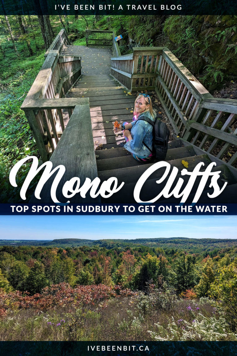
While the lookout along the Cliff Top Side Trail does offer some great views, they’re not nearly as fabulous as those you’ll find along the Lookout Trail. This is definitely one of the harder trails in the park as it has rough terrain so you’ll want to watch your step. However, all your hard work will be rewarded!
The most common way to access the Lookout Trail is from the Walter Tovell Trail. Following this route, be prepared for a solid workout as there is a decent elevation gain. Admire the enormous tree as its long branches loom over the trail as you make your way up to the best views of Mono Cliffs Provincial Park!
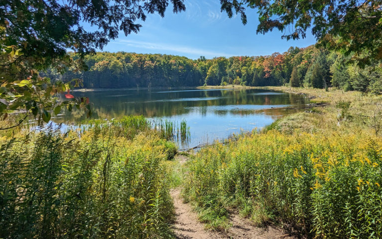
Views of McCarston’s Lake From the Trail
McCarston’s Lake Trail (3.6 km)
This is one of the lesser-known features of Mono Cliffs Provincial Park but it’s not to be missed! McCarston’s Lake was formed as over one kilometre of glacial ice melted slowly northward approximately 11,000 years ago. As this process occurred, large chunks of ice were left behind and buried by gravel and debris to form shallow, circular depressions known as kettles. These lakes have no source of water so they are created during thaws and the collection of rainwater!
McCarston’s Lake is a great example of one of these kettle lakes. This peaceful spot is perfect for taking a break to rest as you enjoy the stunning reflections within the water. It’s especially breathtaking as the leaves begin to change!
South Outlier Trail (3.5 km)
This trail starts off with a steep climb along uneven switchbacks by the Carriage Trail. While it will require some concentration and a certain amount of fitness, it’s a stunning trail that feels as though you’re crawling through a mystical-like forest.
The South Outlier can be done as a loop on its own or you can explore more of the Mono Cliffs Provincial Park trails by connection to the Walter Tovell Trail.
Spillway Trail (1.3 km)
The Spillway Trail runs through the middle section of the park and acts as a connector trail. For the most part, it’s a dirt path that takes you past a variety of trees. There isn’t much elevation here so it’s a nice leisurely stroll compared to some of the other trails in the park.
Walter Tovell Trail (4.8 km)
Named after the late Dr Walter Tovell, this trail is in honour of a geology professor at the University of Toronto who wrote a guide to the geology of the Niagara Escarpment which helped many Ontarians better understand its creation. This has helped to protect the area so that we can still enjoy its beauty and that of the Bruce Trail to this very day.
If you’re looking to break up your day of hiking with a bite to eat, the Walter Tovell trail connects with the quaint hamlet of Mono Centre. This is where you’ll find the Mono Cliffs Inn, a small family farm from the 18oos which has been transformed into an adorable restaurant that welcomes hikers. Take a seat in the pub downstairs or enjoy a meal in the dining room but whatever you do, don’t forget to say hello to ‘Old Maggie’, the resident Magnolia tree!
The Walter Tovell Trail runs the entire length of the park, connecting to the 25th Sideroad and County Road 8. It passes by a few small bodies of water and overall is a stunning trail within Mono Cliffs.
Bruce Trail (varies)
While it isn’t officially a Mono Cliffs Provincial Park trail, it does venture along parts of the Cliff-Top Side Trail, McCarston’s Lake Trail, South Outlier Trail and Walter Tovell Trail. The white rectangular blazes you see on the trees signify the Bruce Trail route through the park.
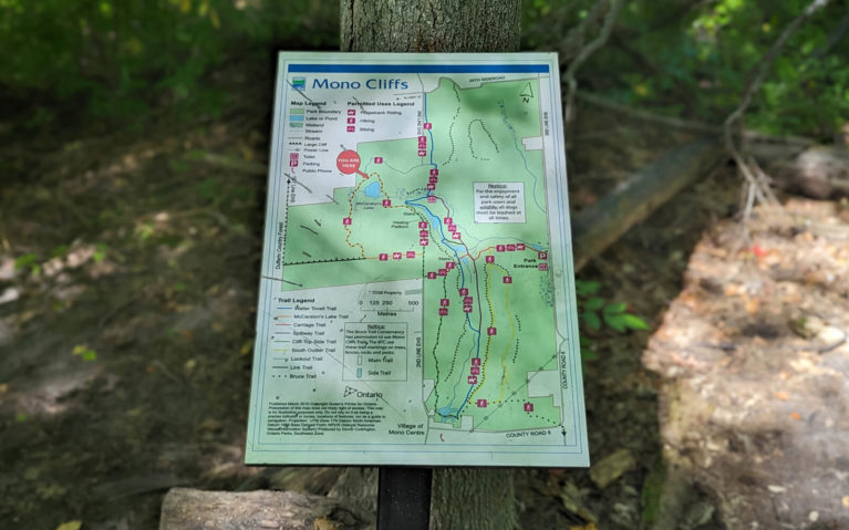
Mono Cliffs Provincial Park Map
Best Mono Cliffs Provincial Park Trail Route
If this is your first time visiting the park and you’re looking to really experience it to the fullest, you’ll want to follow this route. It took me approximately four hours to complete and I hike at a steady pace, however I like to stop and take a lot of photos which eats up some time!
From the parking lot, follow the Carriage Trail to the right and connect with the Spillway Trail. Follow this until you reach a set of outhouses. Just past this, you’ll be faced with a fork in the trail. This is where most go left to head to the cliffs but instead, you’ll want to take the Walter Tovell Trail to the right. Connect with the Lookout Trail and follow it up to the towering tree and brilliant views over the park before descending to connect with the McCarston’s Lake Trail.
Head towards the lake by turning left which will lead you to the Cliff Top Side Trail and the stairs into the cliffs. Pop down there to experience the “Mono Cliffs” and then continue onwards for the lookout platform. You’ll reconnect with the Carriage Trail just a few hundred metres past the viewing platform. Follow it down a stunning set of wooden stairs to the Walter Tovell Trail once again and head south. This will connect you to the South Outlier Trail and you’ll want to follow the western portion of the loop as you walk close to the edge of the Niagara Escarpment.
As you reach the top of the loop, descend down the cliffside as you tackle the switchbacks to reconnect with the start of the Carriage Trail. Just a few hundred metres and you’ll be back at the parking lot. Congrats – you’ve officially hiked a piece of every single trail in Mono Cliffs Provincial Park!
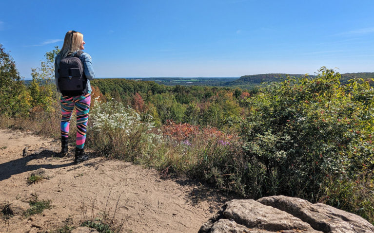
Views from the Lookout Trail in Mono Cliffs Provincial Park
Plan Your Mono Cliffs Visit
Have I enticed you to visit with all these juicy trail details? I sure hope so because Mono Cliffs Provincial Park is one special place in Ontario! Here is what you need to know to plan your visit to the park as well as some frequently asked questions.
Do I Need a Reservation to Visit Mono Cliffs Provincial Park?
Yes, you must have a reservation for Mono Cliffs Provincial Park and it can be made up to five days in advance here. For more details, visit the Ontario Parks guide to visiting Mono Cliffs PP here.
What Are the Mono Cliffs Provincial Park Hours of Operation?
Mono Cliffs Provincial Park is open daily from 8:00 am until 8:00 pm in the summer until the Thanksgiving weekend. Afterwards, it changes to 8:00 am until 6:00 pm.
How Does The New Automatic Gate System Work?
You can check out my reel here for a step-by-step guide on how to register and use the new gate system for 2023. Or, pop up to the Accessing Mono Cliffs Provincial Park section of this blog for thorough instructions.
Can You Go Camping at Mono Cliffs Provincial Park?
No, you cannot camp at Mono Cliffs Provincial Park. It’s considered a non-operating park meaning limited amenities are available and it’s meant for passive recreation only. There are no Mono Cliffs Provincial Park cabins or anything like that. If you’d like to stay overnight close by, I recommend taking a look at my Orangeville guide for some ideas.
If You’re Looking for More Ontario Parks Guides…
Hiking, Biking & More at Bronte Creek Provincial Park
Everything You Need to Know About Long Point Provincial Park
Your Eagle-Eyed Guide to Mikisew Provincial Park
Camp Your Heart Out at Oastler Lake Provincial Park
Enjoy the Shores of Lake Erie at Rondeau Provincial Park
See Why You Need to Rent a Cabin at Silent Lake Provincial Park
Don’t Miss This Hiking Guide to Short Hills Provincial Park
Give Winter Glamping a Go at Killarney Provincial Park
Enjoy a Chill Winter Escape at Windy Lake Provincial Park
Disclaimer:
This post is brought to you in partnership with Ontario Parks. While I was compensated for my time, all of the content and opinions here are honest and speak to my personal experience!


Share Your Thoughts